


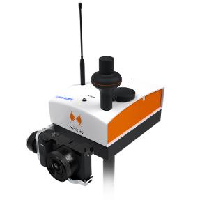
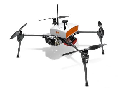
FoxyWalk, terrestrial photogrammetry pole
بيجويتيري والهواية
المجوهرات - المجوهرات - بيجويتيري
وصف المنتج
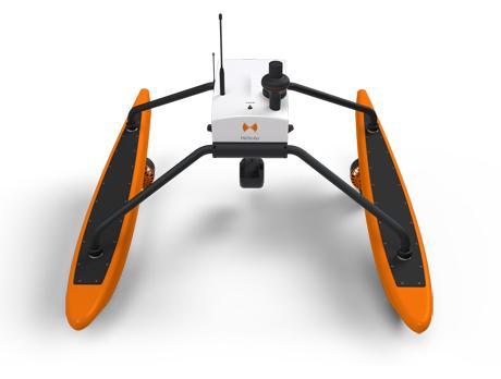
FoxyWalk, terrestrial photogrammetry pole;
FoxyWalk is a platform for easy terrestrial photogrammetry. It is aimed towards surveyors, topographers, architects, archaeologists. It allows the shooting of photos which would be inaccessible from the sky (facades, arches, etc.) and creation of 3D models. Perfect for complementary data acquisition of a drone survey. Terrestrial photogrammetry allows the survey of the shape and dimensions of inaccessible objects, study of deformations and analysis of structural anomalies. It may also be used in determining volumes. Terrestrial photogrammetry applications are varied : Reconstruction of facades, heritage conservation, monitoring structures and sites as well as supplementing aerial surveys and surveys of routes, ditches and open trenches with georeferencing networks (DT-DICT).
مناطق التجارة
منتجات

FR
بيجويتيري والهواية, المجوهرات - المجوهرات - بيجويتيري

FR
بيجويتيري والهواية, المجوهرات - المجوهرات - بيجويتيري

Copyright Netetrade 2025. Developed by Yartu Labs