


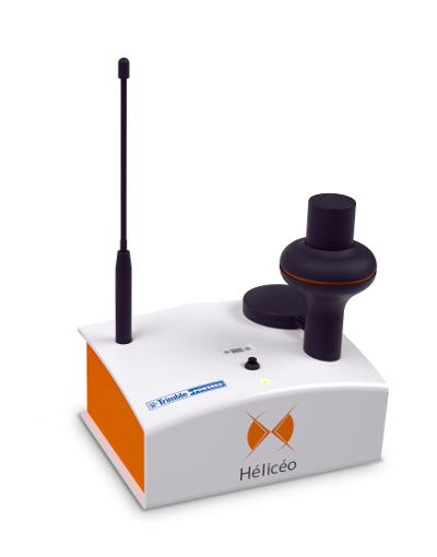
DroneBox RTK, GNSS solution for precision measurements
بيجويتيري والهواية
المجوهرات - المجوهرات - بيجويتيري
وصف المنتج
DroneBox RTK, GNSS solution for precision measurements;
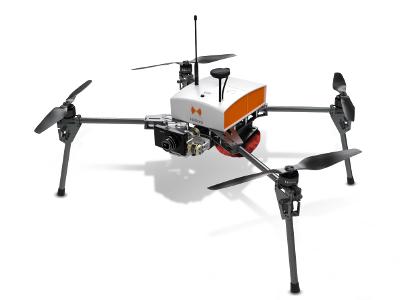
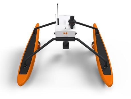
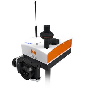
Hélicéo created the DroneBox technology in order to meet the demands of professionals for multiple applications as well as to address the economic challenge of needing multiple types tools. This “Plug & Play” device is adaptable across Hélicéo’s entire range of products, allowing you to perform precision measurement with multiple vehicles and sensors while reducing your investment. The DroneBox, which may be used onboard any Hélicéo vehicle, uses Network Real Time Kinematic (NRTK or RTK) technology, thus providing precision measurement using satellite corrections in real time in order to achieve precision measurement to centimeter accuracy. DroneBox has the following integrated key functions: GNSS geodetic mapping, autopilot, telemetry, archiving, communication, flight controller and avionics.
مناطق التجارة
منتجات

FR
بيجويتيري والهواية, المجوهرات - المجوهرات - بيجويتيري

FR
بيجويتيري والهواية, المجوهرات - المجوهرات - بيجويتيري

Copyright Netetrade 2025. Developed by Yartu Labs